| Geometry type | WKT representation | Comment |
| point | POINT EMPTY | empty point |
| point | POINT ( 10.05 10.28 ) | point |
| point | POINT Z( 10.05 10.28 2.51 ) | point with Z coordinate |
| point | POINT M( 10.05 10.28 4.72 ) | point with M coordinate |
| point | POINT ZM( 10.05 10.28 2.51 4.72 ) | point with Z coordinate and M coordinate |
| linestring | LINESTRING EMPTY | empty linestring |
| polygon | POLYGON (( 10 10, 10 20,20 20, 20 15, 10 10)) | polygon |
| multipoint | MULTIPOINT Z(10 10 2, 20 20 3) | multipoint with Z coordinates |
| multilinestring | MULTILINESTRING M(( 310 30 1, 40 30 20, 50 20 10 )( 10 10 0, 20 20 1)) | multilinestring with M coordinates |
| multipolygon | MULTIPOLYGON ZM((( 1 1 1 1, 1 2 3 4, 2 2 5 6, 2 1 7 8, 1 1 1 1 ))) | multipolygon with Z coordinates and M coordinates |
In this blog you can find some of my findings as an opensource geospatial developer.
Monday, November 28, 2005
wkt syntax (howto)
Thursday, November 24, 2005
Advanced drawing in chameleon
Wednesday, November 23, 2005
opensource gis desktop clients
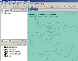
- uDig (http://udig.refractions.net/confluence/display/UDIG/Home ) is a java-eclipse based environment for viewing maps (.shp,tiff,wms,wfs,postgis). The eclipse environment offers you ease of configuration to build your own gis-cleint.
- gvSig is a free multi langual gis-client in java by a spanish firm (wms, wfs). (http://www.gvsig.gva.es )
 Basic clients
openEv is a basic gis-viewer by frank warmerdam (http://fwtools.maptools.org/ )
development environments
Lots of groups offer platfoms in which you can easily build your own desktop gis client.
http://www.geovistastudio.psu.edu
http://www.vividsolutions.com/jts/jtshome.htm
Free clients
- the guys at http://www.tatukgis.com created a Delphi.net environment in wich you can build your own viewer with a few clicks. But they also offer e simple viewer for free. Tatuk manages to put all gis-functionality in just a tiny 10mb application.
soon to come
- At http://fmaps.sourceforge.net they are coding to bring a decent gis-client to the linux-platform. They use postgis to store data.