In this blog you can find some of my findings as an opensource geospatial developer.
Friday, December 09, 2005
http://local.live.com/
Well, another mapping service popped up. Microsoft inproved its msn virtual earth to create http://local.live.com. Some gui-improvements are implemented, but the most interesting thing are the bird-eye views of some mayor downtown areas in the US. Pictures have been taken by Pictometry International Corp. with low flying airplanes. From each point you can look into four directions.
Friday, December 02, 2005
MapServer + Autodesk = ... Enterprize?
This week autodesk and mapserver announced a cooperation in a new project MapServer Enterprize. A GPL project in which both organisations combine their technologies, to generate a new open source gis internet tool in which developers can use php, .net or java. New for the mapserver users are autodesks vector-viewing possibilities (where is SVG/GML?) and a desktop tool to configure the gis-data (at last!).
Well good news i guess. Though autodesc, not specifically being a GIS company, might not be my first choise to cooperate with. However they have a zilion of users. If they all are using MapServer soon, the comunity will be bigger than the mozilla team...
Download an early release here: http://www.mapserverfoundation.org/mapserver_enterprise
Monday, November 28, 2005
wkt syntax (howto)
Geometry type | WKT representation | Comment |
point | POINT EMPTY | empty point |
point | POINT ( 10.05 10.28 ) | point |
point | POINT Z( 10.05 10.28 2.51 ) | point with Z coordinate |
point | POINT M( 10.05 10.28 4.72 ) | point with M coordinate |
point | POINT ZM( 10.05 10.28 2.51 4.72 ) | point with Z coordinate and M coordinate |
linestring | LINESTRING EMPTY | empty linestring |
polygon | POLYGON (( 10 10, 10 20,20 20, 20 15, 10 10)) | polygon |
multipoint | MULTIPOINT Z(10 10 2, 20 20 3) | multipoint with Z coordinates |
multilinestring | MULTILINESTRING M(( 310 30 1, 40 30 20, 50 20 10 )( 10 10 0, 20 20 1)) | multilinestring with M coordinates |
multipolygon | MULTIPOLYGON ZM((( 1 1 1 1, 1 2 3 4, 2 2 5 6, 2 1 7 8, 1 1 1 1 ))) | multipolygon with Z coordinates and M coordinates |
Thursday, November 24, 2005
Advanced drawing in chameleon
Wednesday, November 23, 2005
opensource gis desktop clients
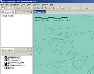
- uDig (http://udig.refractions.net/confluence/display/UDIG/Home ) is a java-eclipse based environment for viewing maps (.shp,tiff,wms,wfs,postgis). The eclipse environment offers you ease of configuration to build your own gis-cleint.
- gvSig is a free multi langual gis-client in java by a spanish firm (wms, wfs). (http://www.gvsig.gva.es )
Basic clients
openEv is a basic gis-viewer by frank warmerdam (http://fwtools.maptools.org/ )
development environments
Lots of groups offer platfoms in which you can easily build your own desktop gis client.
http://www.geovistastudio.psu.edu
http://www.vividsolutions.com/jts/jtshome.htm
Free clients
- the guys at http://www.tatukgis.com created a Delphi.net environment in wich you can build your own viewer with a few clicks. But they also offer e simple viewer for free. Tatuk manages to put all gis-functionality in just a tiny 10mb application.
soon to come
- At http://fmaps.sourceforge.net they are coding to bring a decent gis-client to the linux-platform. They use postgis to store data.
Thursday, October 20, 2005
sql-flavours
Friday, October 14, 2005
bbbike.de (open source navigation)
We recently discoverded an open source navigation tool (to calculate shortest distance between points of interest) at www.bbbike.de It can be used as a standalone perl desktop application or in combination with mapserver as a server based navigation tool on the web. Good work, as far as we know, the first open source navigation map.
Friday, September 16, 2005
Eclipse all-in webdevelopper
A special plug-in is available to work with cold fusion (cfeclipse) this plug-in has equal capacities as studio/homesite (like syntax highlighting,collapsing).
Another nice thing is that it runs on java and you don't need to install anything to get eclipse going, so if we visit a customer where we do not have lots of privileges, we copy eclipse to the harddrive and start working.
Some disadvantages are: the total code is at least some 200mb of files (huge download) and it runs on the java-platform which sometimes gives some performance issues on windows computers.
Mapserver virtualspatialdata
The application is based on chameleon/mapserver. To present the data virtualspatialdata is used. The mapserver Wiki gives a clear description on how to implement is. However i'd like to point you on a single issue.
When i first tested my virtual ogr file using ogrinfo (on a windows 2000 sp3 server), I recieved messages that the file gcs.csv could not be opened, containing the projection information.
ERROR 4: Unable to open EPSG support file gcs.csv. Try setting the GDAL_DATA environment variable to point to the directory containing EPSG csv files.
ERROR 1: Failed to import LayerSRS `EPSG:28992'.
The reason was that i hadn't run setenv.bat.
Later when i tried to view the virtualdatalayer in mapserver i got the same messages. Apparently mapserver/apache/ogr also didn't know where to look for the projection-files. After introducing the parameter gdal_data in apache config the layer was displayed properly.
SetEnv gdal_data "/ms4w/tools/ogr-utils/data"
Good luck trying out yourself.
Wednesday, July 27, 2005
Msn virtual earth
*fun* Do you know what material the moon is made of primarily? Find out by zooming in at any position at http://moon.google.com
Tuesday, July 26, 2005
chameleon-shirts
http://www.cafepress.com/maptools
Tuesday, June 21, 2005
satellite imagery of europe in Google maps
Very interesting is the imagery of Africa. A part of the world where not much internet-mapping is available (in most cases, no maps are available). Maybe the google service can aid scientists and development workers there by providing easy-to-use, fast imagery of the region. Personally i visited Cameroon, Kenya and Guinee and could easily point out the various trips i made to maintains and cities.
Friday, June 10, 2005
Variables in CF
<cfset x["y.z"] = "a">
#x.y.z#
#x.y.z#
#x["y.z"]#
</cfoutput>
the amazing world of CF
Wednesday, April 27, 2005
Introduction of new srid to load autodesk data for mapguide not supported by oracle?
In the fix ISIS, amongst other things, introduces a new srid in Oracle (srid 19025), similar to RD (dutch standard system).
However yesterday i learned this fix is not officially supported by Oracle. So lots of organisations will miss oracle support when there software solution fails. The province of Limburg didn't agree with the ISIS-fix and tried to find another solution, so they brought a team of Oracle, Autodesk and other developers together working on an Oracle supported fix. The project is in full progress and a fix is expected soon.
read more
introducing an srid in oracle (autodesk)
known bug in 8i/9i with srs's (autodesk)
problems showing oracle data in mapguide (autodesk)
Loading data from autodesk (oracle)
Nice mapping application (limburg)
Tuesday, April 26, 2005
the world of fusedoccing
AutoFusedoc is a plugin for Homesite/CFstudio. When pressing ctrl-shft-d it scans the current document and generates fusedoc including io-parameters it can find in the cf-code and the name of the current file. It saves you lots of hours for only $50,- (if you have applications of 1000+ files like we do)
There is a tool out there, fusedocer, with which you can automatically read all fusedocs from all files in your Fusebox 3 application and generate a nice report from it. We're currently improving the tool, to make it more stable (right now it crashes on simple cf-errors). When we're ready you can download it here. Those guys are working on a version for Fusebox 4.
Fusebox 3 to 4 converter: well if you've got your code in FB 3, why not change it to 4 and profit from the performance gain. It needs some manual fine tuning, but the xml-generation is perfect!
Tuesday, April 19, 2005
Macromedia -> Adobe
Other issue: ColdFusion incorporated open source pdf-generation in it's latest release. I guess it will be depreciated soon.
By the way Macromedia still sells Homesite and ColdFusion, which they acquired, when bying Allaire a couple of years back, probably the Macromedia product line will still be available for a while.
Thursday, April 14, 2005
Smallworld 4 introduced
News about the 4-upgrade is that, unfortunately it is not downwards compatible to code added in Smallworld 3. So probably it will take up to 2 years to get everybody upgraded. Thank you GE, to having saved our developer-jobs.
Wednesday, April 13, 2005
alternative for a virtual oracle data layer in mapserver?
select
MDSYS.SDO_GEOMETRY(
2001,
900211,
MDSYS.SDO_POINT_TYPE(st.x, st.y, NULL),
NULL,
NULL) as geom
from world.data st
good luck!
By the way mapserver 4.4.2 has arrived (i hope they fixed some mis-configurations in the precomiled win32 binaries with oracle support)
Wednesday, April 06, 2005
Mapping Google
Have a look at this article, this dude checked out how google maps works
as simple as possible, but no simpler: Mapping Google
Thursday, March 31, 2005
New css stuff
- clagnut.com (firefox only) these guys present draggable, resizable stickies (found at www.stylegala.com).
- alistapart.com shows a pure css menu, but it looks very non-css.
- Walter zorn created some scripts to enable dynamic drawing in your html-website. Draw a polygon and submit, write the form-fields to your oracle spatial db and a simple red-lining module was born.
By the way, do you need a small, free, windows photo editor and don't want to install the gimp? Try http://photofiltre.free.fr
Wednesday, March 30, 2005
label angle in mapserver
Tuesday, March 29, 2005
FGS Linux Installer
- Redhat 8, 9
- Fedora Core 1, 2, 3
- RedHat Enterprise 3
- Debian
- Gentoo
- Suse 8
The package contains things like apache, php, mapserver, gd, gdal, proj, tiff, jpg and freetype
Extra modules are available like mysql,postgis,chameleon. I hope this package solves some installation problems for some of you. Somebody any idea why suse 9 is not supported?
Thursday, March 24, 2005
alternatives for sqlplus/enterprice manager console
- www.sqltools.net brings a free lightweight oracle client, but unfortunately without support for spatial fields.
- www.sqlpal.com has a free java client that can connect through jdbc, for that reason it doesn't need oracle client to be installed at the local machine. sqlpal can't show spatial fields either.
- www.toadsoft.com sells a commercial client which can show spatial fields, and a free client which can not (free license has to be updated every 3 months).
- www.dbtools.com sells a commercial client that can connect to lots of databases, including oracle (display of spatial fields unknown). Their free license can connect to mysql, postgres, interbase and sqllite. Very usefull to convert msAccess to MySql
Tuesday, March 22, 2005
Mapserver hosting
mapserver hosting | price ?/month | disk | postgis | mysql | php |
http://htmlx.com | 15 | 500 | y | y | y |
http://www.zopecms.de/ | |||||
http://www.dvm.at/mapserver.html | 36 | 1000 | y | y | |
www.gishosting.net | | ||||
www.nieuwland.nl | 25 | 100 | y | y | y |
http://www.eikonix.net | 89 | 1000 | y | ||
http://www.sibern.com.au | 110 | y | y | y | |
http://www.gdv-gis.de/hosting/ | 30 | 500 | n | n | n |
http://mapserver.eligeos.org/ | |||||
http://textdrive.com/ | 12 | 300 | y | y | |
http://www.gislogic.com/hosting.cfm | y | y | y | ||
http://www.pghoster.com | y | y | y |
did i forgot your company, send me an email.
webbased ftp client
By the way, wanna see some nice aerials from barcelona, check this out: http://www.gencat.net/ptop/actuacions/hipermapa.htm
Wednesday, March 16, 2005
So you wanna boycot some bad companies...
After subscribing send me an email and i'll invite you to some boycots (the way to earn karma-dollars)
"name can't be empty"... what?
And now this: while doing CF-webservices 1000 of times already i've seen the CF-quote: '[java.lang.IncompatibleClassChangeError : Dependent CFC type(s) have been modified. Please refresh your web service client.]'. Some discussion can be found on the net, but nobody really can tell what's going on. First try to clean up the webservices cache in cf (use this script). That solved some, but not all problems. I ended up renaming all the cfc's i extend with the webservice and the references to them. That did the trick, but in the end leaves me with cfc's called error23.cfc
i hope so much CF7 solves these issues. Hope to tell you about it soon.
Tuesday, March 15, 2005
Now it's time for some interactivity
click=zoom in;ctrl-click=zoom out;shift-click=recenter
why guinea? well i've got some family there...
mapserver/oracle on win2000/iis
after starting up by placing the files in the required directories, i found out (type mapserv.exe on the dos-prompt, fix dependencies until: 'This script can only be used to decode form results and should be initiated as a CGI process via a httpd server.') some more dll's were needed (msvcp60.dll (windows runtime) and a libpq.dll (postgis), both found in the fwtools package). Then all worked fine, on the winxp-test server (calling mapserv.exe as a cgi should result in 'No query information to decode. QUERY_STRING is set, but empty. '). When i repeated the procedure in the win2000 machine up to type mapserv at the dos-promt. But when trying to call mapserv.exe as a cgi things went wrong. First the very descriptive message 'file not found'. Appeared to be a problem with rights, i had to tell this IIS to permit .exe programs (also you have to allow script execution in the folder). When i fixed that i got a blank response on all my requests. I thought iis was the problem, but when i replaced the binary by a slightly newer binary found at http://fwtools.maptools.org, an answer as expected was shown (but this binary doesn't have oracle support unfortunately). So somewhere in that server is a misconfiguration or dependency, which i can't resolve, because mapserver-logging was not triggered (Does iis have a logging option?).
oh, do i love compiling my own progs in linux, easily add all the options i want, and skip all the utilities i don't need, they only give unwanted side effects.
By the way i used gdaltindex.exe (part of fwtools) for the first time today. It is used to make a tileindex of a set op jpg/tiff aerial photo's (and add all photo's as a single layer in mapserver). This really works great: 'c:\profi\fwtools\bin\gdaltindex indexname c:\data\photos\*.jpg'. Be sure to have a world file (did you know all *.tfw (for tiff) *.sdw (for mrSid) can be renamed to *.wld and instantaniously work for jpg's) for each image (type 'copy *.tfw *.wld' at the dos-prompt). If the location of the photo's changes, re-run gdaltindex or open the shape dbf in Excel and search/replace the file location in the location field.
I forgot to tell you about the ora-03113 error, according to resources on the net, it is the error oracle throws when it doesn't know what went wrong. Since we were getting it when creating materialized views on large tables, i suspect it's a memory problem (experts say: try increasing the buffer size... well were can i find the buffer-button?)
FarCry open cms in cf
Unfortunately one of the greatest open source CF projects is not available in cfopen.org. Farcry is a spin-off of the discontinued Allaire Spectra project. Spectra has been used by some large firms, a lot of them switched to Farcry now. It takes some time to get used to the large file structure, but possibilities are limitless.
Read about FarCry at http://farcry.daemon.com.au/
New gdal version 1.2.6 available
Monday, March 14, 2005
Cold Fusion Image manager for htmlarea 2 and htmlarea 3
download image_manager4htmlarea3.zip
For htmlarea 2 I develloped a basic file manager in coldfusion. Get it here: image_manager4htmlarea2.zip
Recently the developers of htmlarea discontinued htmlarea 2/3 and removed it from their website. They launched a new site, htmlarea, in which they offer a listing of all kinds of wyswyg editors. htmlarea is only available via the wei-module at sourceforge.
cfopen.org
This weekend found a nice initiative: http://www.cfopen.org/, which must have been around since mid 2004. Unforunately not much is going on in the forums. So i'm curious whether there will be some response on my questions about the two most interesting projects: cfbughunt and cfusergroup. Perhaps the coldfusion community is not used to the world of sharing, since all of them payed a lot to macromedia to get started in the first place and most of them still develop apps for CF on Windows using db's like Access and MsSQL.
But still a nice idea, i wish'm good luck.
Sunday, March 13, 2005
Weird bug in winXP 'no disk in \device\harddisk1\dr12' when starting QuickTime
Microsoft wrote a technote on it, but that didn't work for me...
http://support.microsoft.com/kb/330137/en-us
Finally found an answer on some german site.
http://nickles.de/c/a/forum2-537724576.htm
They claim QuickTime keeps a list of recently used items and every time QuickTime starts, checks for the items in the list. Some of the recently used items were on removable drives (memory stick). Quicktime (or is it windows) doesn't recognize the removable drive and shows the error.
Solve the problem by clearing the list of recently used items, or remove the file
c:\docs&seetings\all users\appdata\quicktime\QuickTimeFavorites.qtr
Friday, March 11, 2005
Oracle 9i 3D to 2D data for mapserver
CREATE MATERIALIZED VIEW ITEM2D
BUILD IMMEDIATE
REFRESH NEXT sysdate + 1
AS select
SDO_LRS.CONVERT_TO_STD_GEOM(i.geometry,m.diminfo) as loc
from
item i,
user_sdo_geom_metadata m
where
m.table_name = 'item'
and
m.column_name = 'GEOMETRY'
In for example Toad, the materialized view is not stored in the list of views, but as a table. However the snapshot can not be removed using drop table, instead use drop materialized view ?item2D? (in quotes). Don?t forget to create a new spatial index on the materialized view (since its not a normal view)
INSERT INTO USER_SDO_GEOM_METADATA (TABLE_NAME, COLUMN_NAME, DIMINFO, SRID)
VALUES ('ITEM2D', 'LOC',
MDSYS.SDO_DIM_ARRAY
(MDSYS.SDO_DIM_ELEMENT('X', 180000, 220000, 0.005),
MDSYS.SDO_DIM_ELEMENT('Y', 380000, 450000, 0.005)
),
19025);
and
CREATE INDEX si_ITEM2D on ITEM2D(LOC) indextype is mdsys.spatial_index
Finally installed CFMX 7
Well this is a moment we've been waiting for quite a while. Major issues fixed in this release are:
- Better cfc/Web services support (as we found out unfortunately not all the wishes of the community)
- querynew function can finally set fieldtypes for colums (and it works great!).
- cfdocument and cfreport can easily create pdf docs of db-content (first tests look great, support for divs)
Mapserver project 4 Mambo CMS
Recently a mr Ye Shakka started a new project to bring GIS (UMN mapserver) to the popular world of Mambo CMS (PHP/MYSQL). Off course we encourage the efforts of mr Ye Shakka, but wouldn't it be nicer to integrate exsisting projects into Mambo, like mapbender, chameleon or very basic solutions like inlineWMS and WMC.
Afterall a good moment to join the Mambo community, however when i tried to subscribe the system failed and sent me a blank confirmation email.