Wednesday, November 23, 2005

opensource gis desktop clients

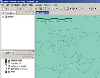
Recently some opensource (free) desktop GIS clients came to my attention.

Basic clients

openEv is a basic gis-viewer by frank warmerdam (http://fwtools.maptools.org/ )

development environments

Lots of groups offer platfoms in which you can easily build your own desktop gis client.

http://www.geovistastudio.psu.edu

http://www.vividsolutions.com/jts/jtshome.htm

http://openmap.bbn.com

Free clients
- the guys at http://www.tatukgis.com created a Delphi.net environment in wich you can build your own viewer with a few clicks. But they also offer e simple viewer for free. Tatuk manages to put all gis-functionality in just a tiny 10mb application.

soon to come
- At http://fmaps.sourceforge.net they are coding to bring a decent gis-client to the linux-platform. They use postgis to store data.

Thursday, October 20, 2005

sql-flavours

when talking to lots of databases you notice there are many flavours of sql. Once in a while it drives me crazy to get for example the syntax for a limit in db2 and so on. Recently i found a nice overview of the different flavours: http://troels.arvin.dk/db/rdbms/ So now we all know that a limit in db2 sql = 'FETCH FIRST n ROWS ONLY'

Friday, October 14, 2005

bbbike.de (open source navigation)


We recently discoverded an open source navigation tool (to calculate shortest distance between points of interest) at www.bbbike.de It can be used as a standalone perl desktop application or in combination with mapserver as a server based navigation tool on the web. Good work, as far as we know, the first open source navigation map.

Friday, September 16, 2005

Eclipse all-in webdevelopper

We recently changed to using Eclipse as a web-editor. Eclipse is an open-source editor which has been designed to program java-applets, but in the meanwhile lots of other tools have been incorporated to support web-development in general. Now we can use 1 tool to edit web-templates, look in to jdbc-databases (oracle,mysql,postgres), do file-comparissons and cooperate using version management.

A special plug-in is available to work with cold fusion (cfeclipse) this plug-in has equal capacities as studio/homesite (like syntax highlighting,collapsing).

Another nice thing is that it runs on java and you don't need to install anything to get eclipse going, so if we visit a customer where we do not have lots of privileges, we copy eclipse to the harddrive and start working.

Some disadvantages are: the total code is at least some 200mb of files (huge download) and it runs on the java-platform which sometimes gives some performance issues on windows computers.

Mapserver virtualspatialdata

It's a long time ago since i posted something here... (got married in the meantime). These days we are working on an application in which users can insert point-data in an mysql-table. The data is displayed in the map afterwards.

The application is based on chameleon/mapserver. To present the data virtualspatialdata is used. The mapserver Wiki gives a clear description on how to implement is. However i'd like to point you on a single issue.

When i first tested my virtual ogr file using ogrinfo (on a windows 2000 sp3 server), I recieved messages that the file gcs.csv could not be opened, containing the projection information.

ERROR 4: Unable to open EPSG support file gcs.csv. Try setting the GDAL_DATA environment variable to point to the directory containing EPSG csv files.
ERROR 1: Failed to import LayerSRS `EPSG:28992'.

The reason was that i hadn't run setenv.bat.

Later when i tried to view the virtualdatalayer in mapserver i got the same messages. Apparently mapserver/apache/ogr also didn't know where to look for the projection-files. After introducing the parameter gdal_data in apache config the layer was displayed properly.

SetEnv gdal_data "/ms4w/tools/ogr-utils/data"

Good luck trying out yourself.